geo_distance_2points()
Applies to: ✅ Azure Data Explorer ✅ Azure Monitor ✅ Microsoft Sentinel
Calculates the shortest distance in meters between two geospatial coordinates on Earth.
Syntax
geo_distance_2points(p1_longitude,p1_latitude,p2_longitude,p2_latitude)
Learn more about syntax conventions.
Parameters
| Name | Type | Required | Description |
|---|---|---|---|
| p1_longitude | real |
✔️ | The longitude value in degrees of the first geospatial coordinate. A valid value is in the range [-180, +180]. |
| p1_latitude | real |
✔️ | The latitude value in degrees of the first geospatial coordinate. A valid value is in the range [-90, +90]. |
| p2_longitude | real |
✔️ | The longitude value in degrees of the second geospatial coordinate. A valid value is in the range [-180, +180]. |
| p2_latitude | real |
✔️ | The latitude value in degrees of the second geospatial coordinate. A valid value is in the range [-90, +90]. |
Returns
The shortest distance, in meters, between two geographic locations on Earth. If the coordinates are invalid, the query produces a null result.
Note
- The geospatial coordinates are interpreted as represented by the WGS-84 coordinate reference system.
- The geodetic datum used to measure distance on Earth is a sphere.
Examples
The following example finds the shortest distance between Seattle and Los Angeles.

print distance_in_meters = geo_distance_2points(-122.407628, 47.578557, -118.275287, 34.019056)
Output
| distance_in_meters |
|---|
| 1546754.35197381 |
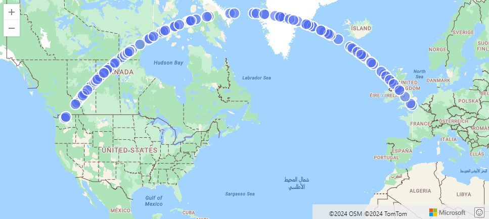
The following example finds an approximation of the shortest path from Seattle to London. The line consists of coordinates along the LineString and within 500 meters from it.
range i from 1 to 1000000 step 1
| project lng = rand() * real(-122), lat = rand() * 90
| where lng between(real(-122) .. 0) and lat between(47 .. 90)
| where geo_distance_point_to_line(lng,lat,dynamic({"type":"LineString","coordinates":[[-122,47],[0,51]]})) < 500
| render scatterchart with (kind=map)
Output

The following example finds all rows in which the shortest distance between two coordinates is between one meter and 11 meters.
StormEvents
| extend distance_1_to_11m = geo_distance_2points(BeginLon, BeginLat, EndLon, EndLat)
| where distance_1_to_11m between (1 .. 11)
| project distance_1_to_11m
Output
| distance_1_to_11m |
|---|
| 10.5723100154958 |
| 7.92153588248414 |
The following example returns a null result because of the invalid coordinate input.
print distance = geo_distance_2points(300,1,1,1)
Output
| distance |
|---|